About RF Terrain Profiles Free
The main features are: - SITES DATABASE. You can create a single or multiple sites over terrain. Also, you can import KML files generated in Google Earth or export KML files to be used in Google Earth. - REPRESENTATION of...
The main features are:
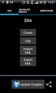
- SITES DATABASE. You can create a single or multiple sites over terrain. Also, you can import KML files generated in Google Earth or export KML files to be used in Google Earth.
- REPRESENTATION of terrain profiles and First Fresnel Zone between two geographical points. You can see immediately if the First Fresnel Zone is obstructed or not by the terrain and the percentage of the First Fresnel Zone clear of any obstructions is automatically calculated.
- OPTIMIZATION of the antenna height in the sites for a given percentage of the First Fresnel Zone clearance. Very useful to find automaticaly the antenna height needed to satisfy with some visibility conditions.
- ORIENTATION of the antennas in azimuth (relative to the North) and elevation (relative to the horizon) between two geographical points. Useful for quickly orientating the antennas situated at the sites.
- LINK BUDGET. The Link budget calculations can be done to determine the maximum allowed path loss, taking into account the equipment configuration elements and parameters (transmitting power, cable loss, antenna gains, sensitivity, etc.)
- DROPBOX. You can store results (sites database, profiles etc) and share them (if you want) instantly with your RF Terrain Profiles user group.
- Digital Terrain Models.
You can calculate profiles (up to 5km), without an additional cost, using the Digital Terrain Model (DTM) provided by GOOGLE with a resolution of 90x90m.
Also, you can use (for any distance between the sites), with an additional cost (0.5 euros per profile), the following INTERMAP data:
- NEXTMap 5m, a Digital Surface Model (DSM) with a 5x5m resolution and a vertical accuracy of +/-1m for Europe Coverage (Andorra, Austria, Belgium, Czech Republic, Denmark, France, Germany, Irland, Italy, Liechtenstein, Luxemburg, Malta, Monaco, Netherlands, Portugal, San Marino, Spain, Switzerland, and United Kingdom) and United States Coverage.
- NEXTMAP World 30m, a Digital Surface Model (DSM) for the World with a resolution of 30x30m and a vertical accuracy of +/- 7m wherever NEXTMAP 5m terrain is unavailable.
RF Terrain Profiles has been developed by Universidad Politecnica de Cartagena and is being commercialized by the company Nitelmur via a contract agreement. The Intermap data is supplied to Universidad Politécnica de Cartagena by Intermap Technologies Inc. via a license agreement.
Previous Versions
Here you can find the changelog of RF Terrain Profiles Free since it was posted on our website on 2014-03-04 22:37:17.
The latest version is 5.1 and it was updated on 2024-04-23 09:52:57. See below the changes in each version.
RF Terrain Profiles Free version 5.1
Updated At: 2014-09-19
RF Terrain Profiles Free version 3.3.1
Updated At: 2013-02-21
Changes: Several fixes and updates
Disclaimer
External Download
We do not host RF Terrain Profiles Free on our servers. We did not scan it for viruses, adware, spyware or other type of malware. This app is hosted by Galad and passed their terms and conditions to be listed there. We recommend caution when installing it.
The APK Download link for RF Terrain Profiles Free is provided to you by apps112.com without any warranties, representations or guarantees of any kind, so access it at your own risk.
If you have questions regarding this particular app contact the publisher directly. For questions about the functionalities of apps112.com contact us.